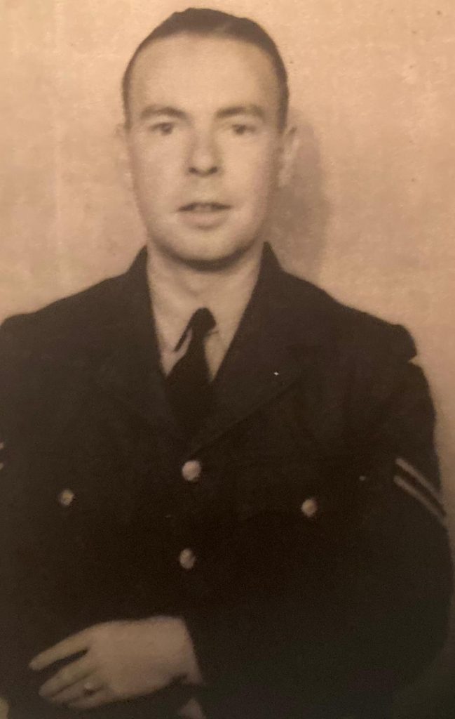
When the Second World War broke out in 1939 Tom decided it made sense to volunteer for active service. He knew that as a journalist he wasn’t going to saved from conscription and an added bonus of volunteering was that he could choose which service he wanted to join. He chose the RAF and in the years that followed ended up in India where among other things he was volunteered to run a concert party. Despite his skill at bending the rules Tom ended up a Corporal.
In the following pages Tom tells how he at least saw a bit of the world “fighting for his country”. Eventually he posted to India and eventually Cox’s Bazaar in what was eventually to become Bangladesh.
All I wanted was a new pair of boots – and I was in Keswick, the English Lake District’s walking HQ so it seemed a sure fire successful shopping outing. First of all I sussed out what what on offer: did you know there are 15 shops in the town, all selling outdoor gear.
A bit of background first. I’ve only ever had six pairs of walking boots in my life. The first were a pair of black leather commando soled Tuf work boots recommended by my scout group and when they wore out I replaced them with another pair of work boots which lasted well into adult hood. Foolishly in the 1970’s I was persuaded by a work colleague who was “very knowledgeable” that I needed proper walking gear and on his advice bought the most expensive, heavy, footwear you could imagine, probably more suited to arctic conditions than the summer moorland walking I was doing.
They weren’t really a success, and wouldn’t wear out, so they were replaced by a much lighter but equally ill-fitting pair which I eventually donated to a walking-boot hire shop having replaced them with a pair made of brushed leather and canvas but lined with gore-tex, a breathable waterproof fabric new to the market (at that time). They were the most comfortable footwear I ever had and survived many miles, including the Coast to Coast Walk, before a split let in water.
The next pair were made of the same material, were £20 in a sale; I bought them because they were comfortable from the first day I wore them, served me for five years and have only just been chucked in the bin after doubling as spares for some time.
So, from this limited experience of boot buying my only criteria was that they had to be comfortable the minute I put them on. I had heard good reports about a particular make and learnt from my walk around Keswick, that only one shop, Blacks, sold these.
However it was clear that the assistant in the store had even less knowledge about walking and boots than I did. I explained I wanted a pair that didn’t have stiffeners in the sole – these are put in to help people who climb rather than walk up hills, allowing them to balance on their toes without the sole of the boot flexing. “All our boots are stiff” he said, picking up random pairs and attempting to flex them.
“Well they would be,” I replied, “they’re stuffed with paper to help them keep their shape in the shop”. He conceded the point, but appeared to get shirty when I picked out three different styles and asked to try a size nine and a nine-and-a-half in each, explaining that I wasn’t sure what size I needed. “I can’t carry that many from the stock room,” he said, scowling when I suggested two trips.
I warned him about his attitude by suggesting that there were 14 other outdoor shops in the town, and I was happy to try them instead if it was too much trouble to assist me.
I really liked the pair I finally chose in the larger of the two sizes, and though it gripped my feet rather too snugly, I was persuaded that they would “give” with time and parted with my cash. The shop assistant, now my best friend, pointed out that if I wanted to wear them for a few hours at home, and changed my mind, I could have a refund or exchange them.
You have probably guessed by now that after several hours wandering round our holiday accommodation, there was no sign of the boots “giving” at all, it was likely the only giving they would be doing was to provide me with a cluster of blisters. At this point Mrs P, she pointed out that my last boots were size 10! Disheartened I trailed back to the shop and got a refund.
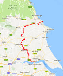
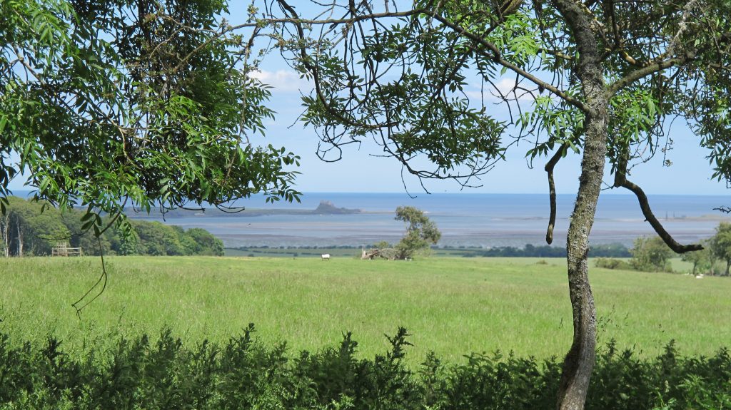
I’ve wanted to walk the Wolds Way for donkey’s years, since the middle of the 1990’s in fact. I had just finished the demanding but enjoyable Cleveland Way, a much to be recommended 109 mile jaunt around the edge of the North Yorkshire Moors, from Helmsley to Filey. There, on the finishing line on Filey Brigg stood a signpost: “Wolds Way, Hull, 79 miles”.
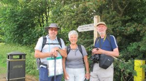
I bought a book and studied the route, but circumstances always got in the way, until May 2018 when with walking partners Michael and Jennifer we set off to walk from the Humber to Filey (it made sense to end at the seaside rather than the other way round).
From the Humber to the seaside
By chance a childhood friend who I’ve seen only a couple of times since, lives in Hull and agreed to both look after our car AND drop us at the start a short distance from our home.
“You can’t come to Hull and not have cod and chips,” said Christine, and despatched her partner Tony to the chippy for a heavy-duty set-you-for-the-day lunch. And with just six or so miles to do on the first day it was no real hardship.
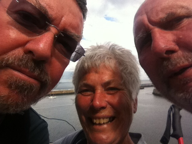
We look like aged walkers, but then we are!
Monday June 11th 2018, Day 1 – Hull to Welton
A quick glance on the map suggested the first day’s route was easy, starting at Hessle foreshore, just follow the banks of the mighty Humber, pause a while to wonder at the Humber Bridge (Factoids: it is 2,430 yards or 1.38 miles long and was opened to traffic on 24 June 1981, at that time being the longest of its type in the world. It is a Grade I listed building and carries well over 120,000 paying vehicles a week).
The bridge crosses to Barton in Lincolnshire
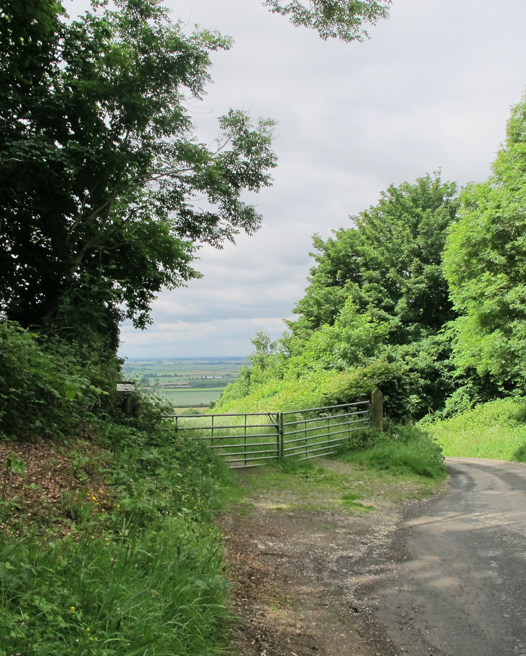
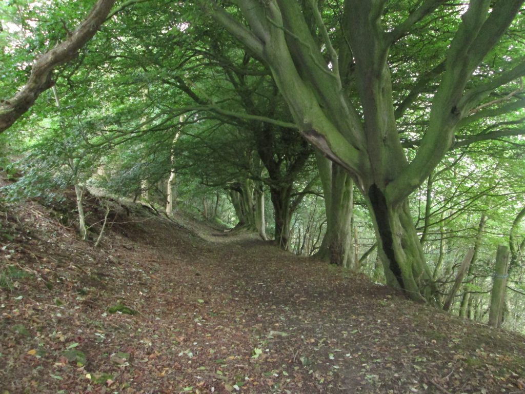
At high tide of course you can’t actually follow the map and have to wind your way through the streets of North Ferriby and then negotiate a busy trunk road interchange. However from there its a woodland stroll into Welton and the end of a short day.
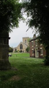
Welton, a pretty commuter village on the outskirts of Hull.
It was here we first met a group of men who became known to us as the walking prophets, a title we adopted when we noticed they said grace before their evening meal at the pub, and almost every time we bumped into them on the route they were at a Church.
Tuesday June 12th, Day 2 – to North Newbald
A great days walk in warm sunshine and our first wold (which incidentally simply means a piece of high uncultivated land) but first Welton Dale and a glimpse of the wonderful scenery that was to become the norm for most of the next few days. Grass as green as grass should be, blue skies dotted with white fluffy clouds and the sound of birdsong.
We were surprised at the number and severity of some of the climbs but there was always the compensation of a downhill stretch to follow and some of the paths, as we pass through Swin Dale, for example followed the contours. On arrival at the Gnu at North Newbald we met our walking prophets again – they’d tried to book rooms but it seems we’d taken the last ones available and they had to beg a lift into nearby Market Weighton.
Wednesday June 13th, Day 3 – to Millington
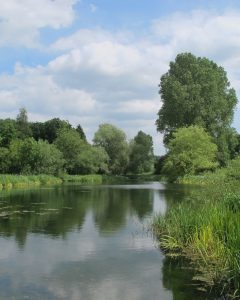
Disaster! During the previous day Jennifer had complained that, for the first time, she thought she was developing a blister. Arriving at the Gnu she discovered it was enormous, had burst and overnight became so painful she couldn’t even bear to put a boot on. So, as she and Michael took a bus to the nearest walk in clinic in Beverly, I set off alone for the 15 miles to Millington. The first section was a slog on tarmac roads crossing open wolds to Goodmanham, and through the pretty Londesborough Park Estate. This is definitely worth a visit even if you aren’t walking. More road then around the contours to Nunburnholme passing the village church (and the Prophets) and on into Millington. The Carters arrived by car! Having had her foot strapped up and been told to walk no further until the wound healed, they’d travelled by bus back to Christine’s house and collected their car which would be Jennifer’s transport for the final days of our walk.
The mere at Londesborough Park
Thursday June 14th, Day 4 – to Thixendale
After a most comfortable night at the Rambler’s Rest we had the bonus of a lift back to where I had left the route the previous afternoon. Although there was the odd shower amid the sunshine, as we climbed back onto high ground along the edge of Warren Dale we felt the full force of the wind which blew for much of the day. Down we went into Sylvan Dale, before climbing steeply out again, across the top only to drop again into Nettle Dale. From here it was real Wold country. Pasture Dale, Frendal Dale and Tun Dale before a spell of open farmland. The scenery was breathtaking. We particularly enjoyed sitting in the Poet’s seat Huggate alongside was a book where you could add your own piece of poetry if you wished. On the bench itself the words: “We have rippled the earth with our desire to be here not there. We have driven the dale’s wedge of hush home between us. But you move, as we moved, in the ghost of water. A hare rips away from the dead, Thuds down the dyke and out into everywhere the grasses foam.” And so Thixendale itself and the welcome sight of the Cross Keys Inn. Panic – we are too early, the place is closed! We need not have worried as we sat at the tables in the small garden the landlord and his lady appeared as if magic and within minutes we had large glasses of cold alcoholic beverage to slake our thirst. The pub itself has an enjoyable air of neglect – a flash back to another time – but our rooms in the annexe were modern, comfortable and well furnished and there was even a heated boot room where wet clothes and dirty boots could be shed. The evening meal and the breakfast the following day matched the friendliness of our hosts: unfussy but satisfying for even the most hungry walker.
Friday June 16th, Day 5 – to Ganton
Before setting off we took advantage of having Jennifer in her car, to drive us to Robert Fuller’s Gallery outside the village of Thixendale. Robert is one of Britain’s foremost wildlife artists selling paintings all over the world. He’s an authority on wildlife often appearing on television mainly because the garden at his home and gallery is full of wildlife in homes he has created which they have inhabited. All are filmed or photographed.
As we climbed out of Thixendale we reached the highest point of the walk 700ft (215m) and then dropped into Deepdale and the deserted Iron Age settlement of Wharram Percy, although most of the remains are of the village that was abandoned in the 15th century. St Martin’s Church is at least recognisable being in use for a further 400 years after the village was deserted.
Beyond Wharram le Street more climbing to Settrington Beacon. Some pleasant woodland preceded a steep climb down to the tiny hamlet of Rowgate and a road stretch to Wintringham. Climbing steeply out of the village we encountered artwork called Enclosure Rites, which celebrates the abundant archaeology of the area. The final stretch that day offered great views before we dropped down to The Greyhound at Ganton, and their motel like accommodation.
Saturday June 17th, Day 6 – to Filey
The final day! Jennifer walked a short way with us as we headed out of Ganton along field paths and back to the tops – and our first landmark of the day, Staxton Wold, site of an important RAF radar station. The next hour or so was very much up and down: Flixton Wold, Raven Dale, Camp Dale and Stocking Dale, beautiful scenery! Soon we caught glimpses of the sea and our destination. Once in the village of Muston the open pub proved too much of a temptation and we paused awhile before make the last push for Filey and the sea.
Where we stayed:
The Green Dragon, Cowgate, Welton, HU15 1NB, Tel 01482 666700
The Gnu, The Green, North Newbald, YO43 4SA, 01430 827473
The Ramblers Rest, Main St, Millington, YO421TX, 01759 303292
The Cross Keys, Thixendale, Malton, YO17 9TG, 01377 288315
The Middleton Arms, North Grimston, Malton, YO17 8AX, 01944 768255
The Greyhound Inn, Main Road , Ganton, YO12 4NU, 01944 710116
Sometimes there are years you will always remember and 2020 will without doubt be one of them. The year the virus struck. At the time of writing it is estimated that 50,000 people have died in the UK from or in some way connected to the Corona virus which causes an illness spookily called Covid-19 like a disease made up by the writer of science fiction.
We’ve been locked down now for eight weeks; and I’ve been out just three times, twice to the postbox and once for a walk. The dog is old now and finds walks too tiring so I’ve used my energy to work in the garden.
It’s about a third of an acre in all and isn’t pristine normally, nor so this year. However I feel more on top of it than in the past and knowing that we aren’t likely to be going away much as the year progresses I’m growing more home produce than ever. Anyway have a look, and enjoy:
UPDATE: June 29th 2020
Time flies when you are having fun or in the world of gardening and July is almost upon us. Many of the spring flowers have “gone over” as my gran would have said but there are signs of the first summer blooms. The sweet peas have a couple of flowers showing and the Verbascum is now taller than me and showing signs of its yellow flowers. Some pansies are hanging on in the container in the woodpile corner having been joined by some geranium plugs which arrived in the post, a gift from my daughter.
Perhaps the best news is that my much loved (and at times admired) Callistemon or Bottle Brush Plant looks as though it is going to be covered in flowers this year. I bought the plant from the salvage corner of a garden centre a few years ago and for a few winters kept it indoors. Then a a friend in Australia pointed out that down-under they grow in profusion in the wild, and stand temperatures well below zero. It has now survived two English winters out of doors and without protection other than its sheltered location. I keep thinking I should plant it in the soil but it seems to be doing ok in a large pot, and who knows, if we ever move, I might want to take it with me.
One potted plant I will take is the Christmas Tree. It was bought from a supermarket two years ago for £2 and was just six inches high. It was covered in glitter and I suspect most people forgot to water them and they ended up in the bin. I transplanted ours into a decent sized pot and it sits in the nursery area where it’s now at least 15 inches high.
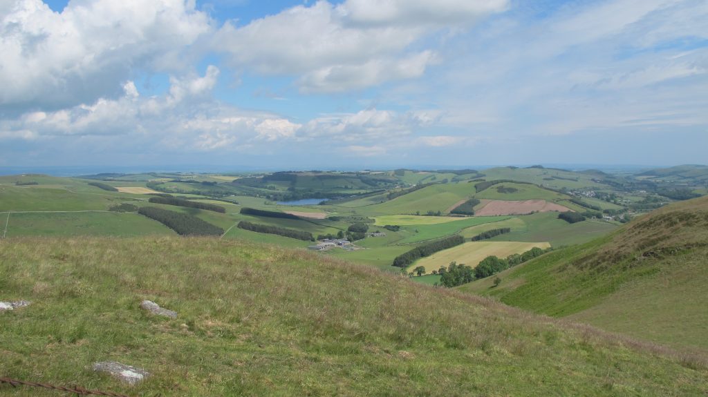
The Carter-Peel walking group headed for the Scottish borders for the 2019 annual trek and a varied, 70 plus mile, jaunt named after Cuthbert, a 7th-century saint. He began his religious life where the walk begins, Melrose Abbey, and ended it where he was first buried on Holy Island, our finishing point.It seems that during his life Cuthbert achieved the rank of Bishop but was made a saint when his coffin was opened some eleven years after his death and his remains were found to be perfectly preserved.
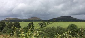
The Eilden Hills
The walk begins with a bit of a haul, the ascent of the Eilden Hills, three peaks that dominate the skyline for miles around. In fact it was almost the last day before we lost sight of them. Fortunately we passed over the saddle, but still a stiff climb in strong winds and the only rain of the week. It was one of those occasions when having stopped to don waterproofs we had to shed them not long afterwards as the sun forced its head through the clouds. The descent was through woodland and the walk continued through field and valley to reach the banks of the River Tweed and on into St Boswells. As it was Monday the recommended bookshop with cafe was closed, but we found that walkers were looked after admirably at St Boswells Golf Club (cup of tea £1). Continuing along the River Tweed the route took us to the Roman Road, Dere Street, and eventually the Harestones Outdoor Centre. Many walkers had arranged a taxi from here into Jedburgh, but a walk along the main road to Lanton allowed us to catch a bus.
One of the great things about this walk was the people we met. Our constant travelling companions (or so it seemed) were Jesse and Hope Suber, Americans, who told us they regularly come to the UK to enjoy our long distance trails; and later we met Jenny Rankin and her friend, Meg also from America. A former church minister, Jenny was researching for a new venture, an Educational Travel Company based in Massachusetts and in the Border Hotel that night she quizzed us about the various walks we have undertaken over the years. They did consider the walk a pilgrimage.
Day 2 – to Morebattle
A taxi back to Harestones put us back on route and soon we were enjoying the sunshine and views on the banks of the River Teviot, passing Monteviot House on the way. The suspension bridge across the water actually wobbled as we walked but the setting was too good to miss a photo opportunity. The stroll along the river was fabulous but all too soon we were onto quiet metalled roads which made up much of the rest of the day to Morebattle.
Day 3 – to Kirk Yetholm
And now the real hills begin. The Cheviots! Grubbit Law, 326 metres; Wideopen Hill, 368 metres dropping down slightly to Crookedshaws Hill and down into Yetholm. A short but exhilarating day with sunshine and a shower.
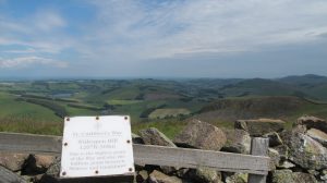
Wideopen Hill was an important stage on the journey. Not only is it the highest point along the route but is also half way between Melrose and Holy Island. Time for more photography:
The view from halfway…at the top of Wideopen HillThe view from Wideopen
The weather remained kind for much of the rest of this relatively short day though as we headed down from the hills towards Kirk Yetholm a short sharp shower reminded us how changeable things can be on higher ground. That said the sun shone as we reached the village pub, The Border Hotel, and a welcome pint (or two) before heading for our guest house.
Day 4 – to Wooler
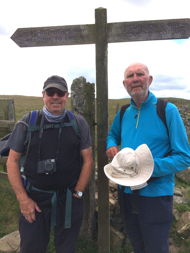
An exciting and important day today because we crossed the border into England. Everyone warned us that the day would start with a tough climb and indeed it did. We followed the Pennine Way for the first mile or so then skirting the hill tops we quickly reached the border.
England one way, Scotland the other
The path from there to the next point of civilisation, Hethpool, climbed and dropped, climbed and dropped until we finally were in a valley which we followed through the village before heading steeply upwards once more on the long haul to the hill tops. Jesse and Hope had been joined by English friends met on a previous trip and they soon passed us as we crossed heather covered and boggy moorland heading for Wooler. It was blowy on the tops and the path was tricky to follow in places, but as we reached a dry stone wall that marked a turn, there, sitting in the shelter were the Pilgrims Jenny and Meg enjoying scones and jam. They’d set off early having heard the day would be a tough one but were pausing for their packed lunch.
We passed Tom Tallons Crag (353 metres) and Gains Law (319 metres) before heading to Humbleton Hill and the start of the descent to Wooler. Another stiffish climb through woodland and then down to Wooler Common and the streets of the town itself.
Day 5 – to Beal
An exciting prospect today was seeing St Cuthbert’s Cave, where, legend has it, the holy man lived for a time before reaching Holy Island and of course sight of the sea itself.
Walking holidays are often about the people you meet en-route and as we strolled through Wooller noticed some rather huge brown and white dogs standing with their feet on a garden gate. Chatting to the lady there it transpired they were hunting hounds from the local hunt and she, like her father before her was a puppy walker. That is she took the puppies and treated them as pets for the first six months of their life. She explained that the main aim was to get them used to humans (particularly children) so that once in the pack there was no risk they would by mistake chase a human instead of a fox (though nowadays the law says it should be a trail laid for them). She was very proud of her dogs and they had even won her prizes in the local show.
We quickly left Wooler behind climbing up onto Weetwood Moor before dropping down to the River Till and an amazing 16th Century bridge near Weetwood Hall. The bridge is a Grade I listed structure. It is thought probable that the English army, commanded by the Earl of Surrey, crossed the River here on the way to Barmoor Castle on the 8th September 1513, the day before the Battle of Flodden.
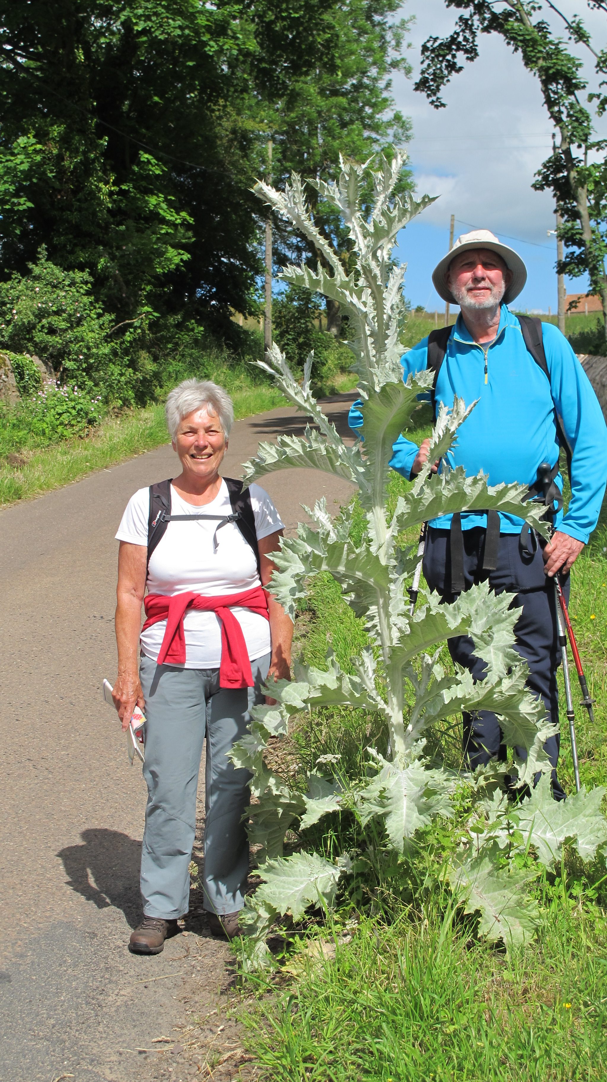
However the star of the show was the enormous “Scottish” thistle growing on the road side just round the corner. Ironic that the first one we see is actually in Northumberland. But as keen gardeners we had to inspect and photograph the specimen.
.
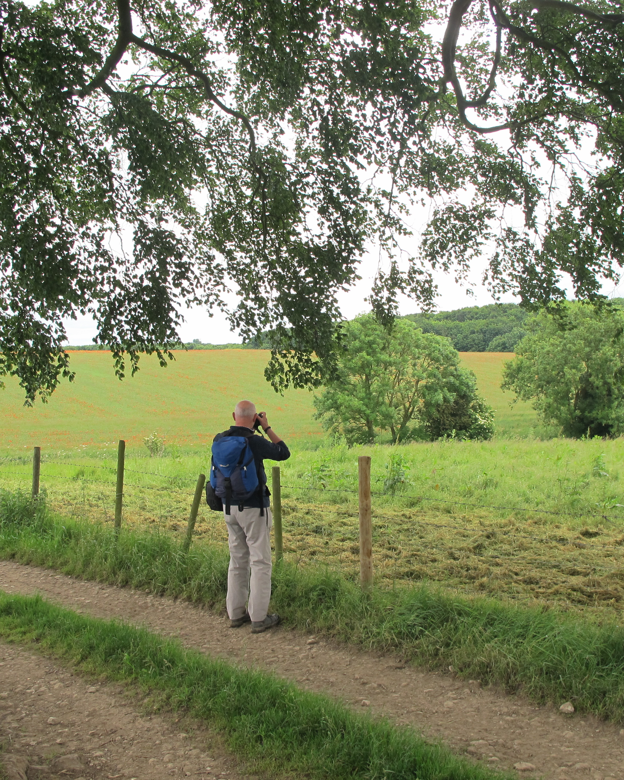
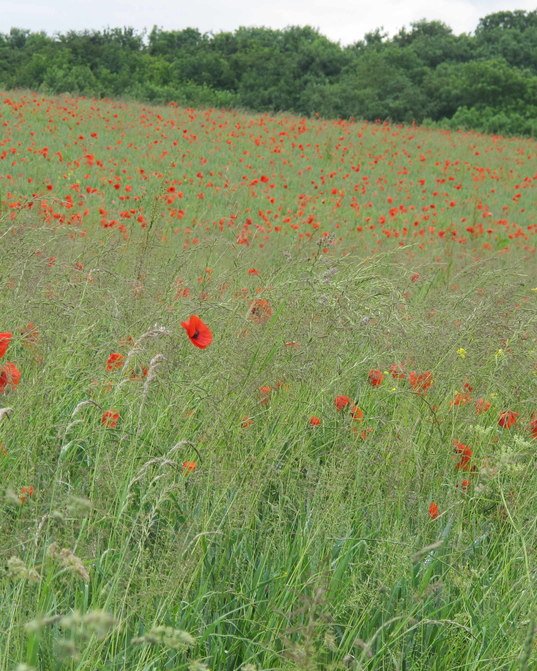
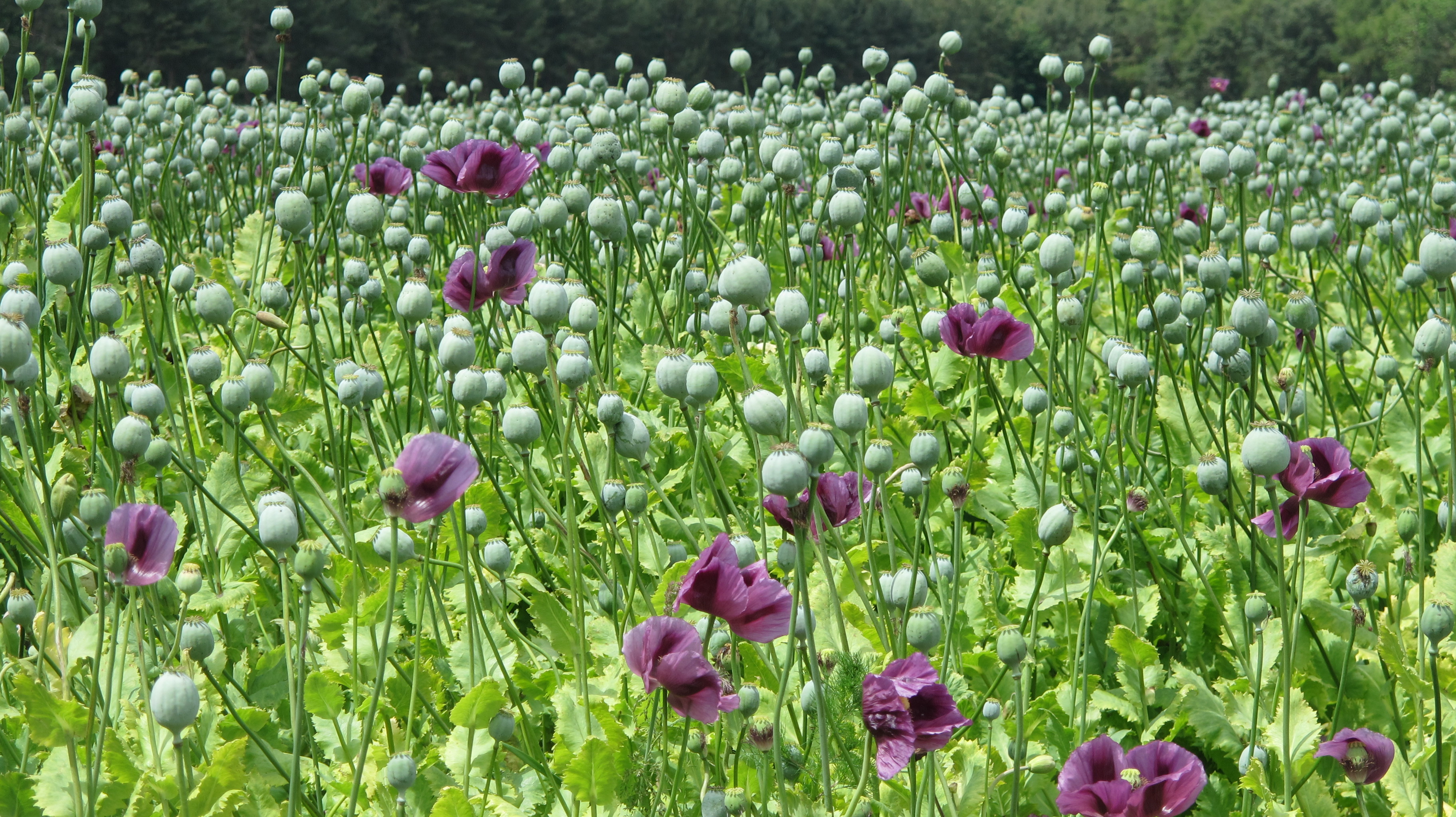
Our next surprise wasn’t long in coming….an hour or so later we chanced upon a field of poppies, not the famous red wild poppies, the symbol of remembrance, but clearly a crop. We speculated that this Northumberland farmer might be secretly harvesting opium, but concluded someone has to grow the poppy seeds you see sprinkled on bread buns. Or perhaps the seeds are processed for their oil. Wikipedia says all these are an option but you can read more here Poppies as a crop
The landscape had changed now with far gentler hills dotted with farms and woodland. After skirting the bottom of Dancing Green Hill and the wooded Cockenheugh hill was found St Cuthbert’s Cave. More an overhanging rock really but it would clearly provide shelter from the wind and rain.
More woodland walking took us to Fenwick and our first sighting of the sea, and in the distance, Holy Island. The path crosses both the A1 (watch out for the traffic) and then the main East Coast Railway where high speed trains regularly travel the journey from London Kings Cross to Edinburgh Waverley. It’s a wonderful journey and the only part of the East Coast line that comes so close to the sea, but crossing it on foot is an experience.
Our first glimpse of Holy Island
First you have to telephone the signalbox from a phone placed on the crossing and are asked how many are in your party and how long will it take you to cross. In our case we assumed it safe because we’d just watched train fly by. But, no, we were told another was due any second and we should call back when it had passed. We did, were given the all clear to continue our journey to Beal. Unfortunately, as it turned out our hotel wasn’t actually in Beal, but next to the A1 which added an unexpected two miles to our walk that day (and the next). Thanks heavens for the caravan site bar which allowed us to refresh before that final extra trek.
Final Day – to Holy Island
We did try and cheat slightly and catch a bus from the hotel back to the landward end of the Holy Island Causeway but St Cuthbert wasn’t having any of it. The bus on the timetable never turned up. The timing was also wrong for us to do the pilgrim thing and walk barefoot across the muddy sand – as long as the tide is right, it is perfectly safe if you follow the prominent markers.
Instead we marched the tarmac among a caterpillar of walkers (including our friends from Florida) heading for Lindisfarne. After such beautiful scenery and footpaths soft underfoot, it was a bit of an anti-climax, something that had to be done, and eventually we reached our destination, which by now as packed with summer tourists.
Where did we stay:
Melrose – Dunfermline House, Buccleuch Street dunfermlne.house@virgin.net (excellent)
Jedbergh – Kenmore Bank Guest House, Oxham Road kenmorebank@gmail.com (excellent)
Morebattle, – Templehall Inn, Main Street enquiries@templehallhotel.com (excellent)
Kirk Yetholm – Mill House, The Wheelhouse, Main Street dedgar189@btinternet.com (excellent)
Wooler – Old Mill House, South Road info@theoldmillwooler.co.uk (excellent)
Beal (two miles away alongside the A1) – Lindisfarne Inn, Beal enquiries@lindisfarneinn.co.uk (adequate)
Luggage: We used The Sherpa Van Project to transfer our luggage from each overnight stop to the next but they contracted out to a local firm. There are other alternatives and you may even find using local taxis is cheaper.
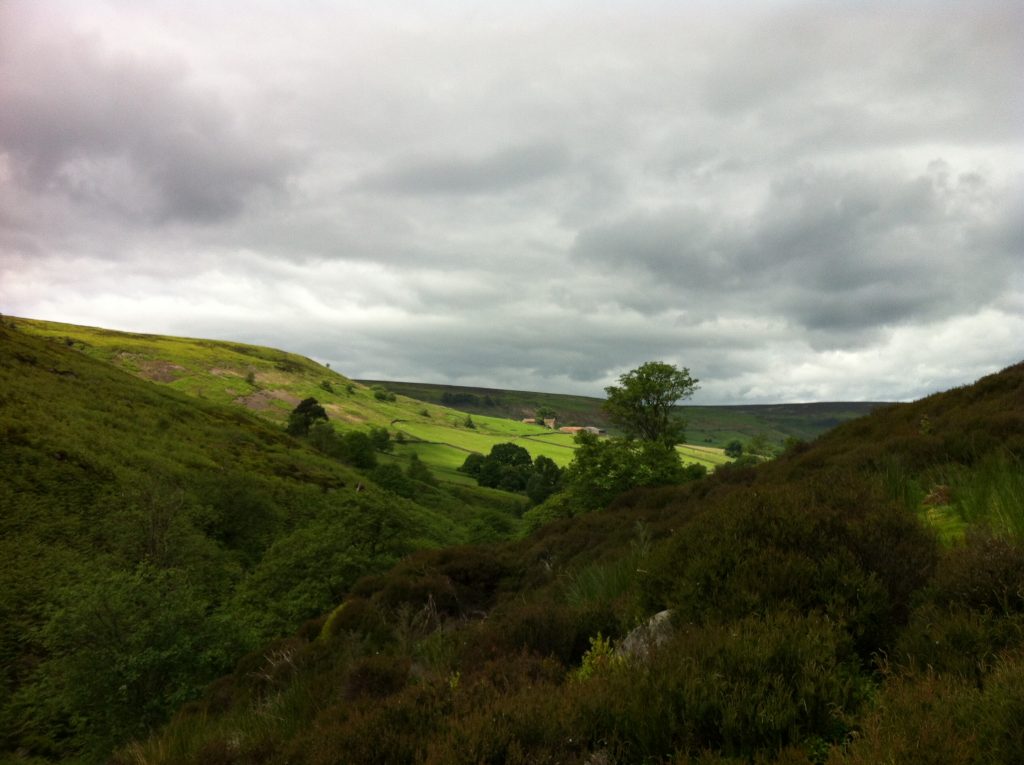
No I hadn’t heard of it before either, but spotted a booklet and route in a N.Y.Moors information place and it piqued my interest. In theory it connects the two ends of the Cleveland Way long distance walk though who would want to walk a further 50 miles to pick up their car in Helmsley having just done 110 tough moor and coast miles, I can’t imagine.
However as a stand-alone route it follows the southern edge of the moors park and can be split conveniently into four 12-ish miles stretches, perfect for a short walking break. I did the route in mid-September after a week of heavy rain but was lucky enough to enjoy sunshine and dry days though the wind was strong at times.
Starting the walk
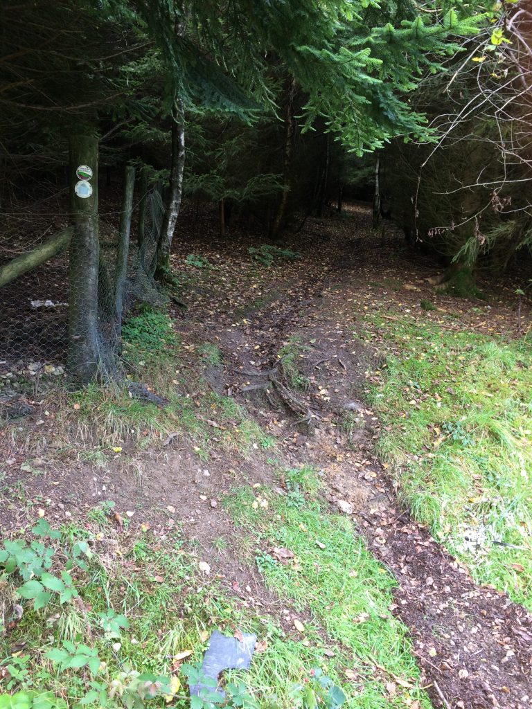
The walk begins on the Cleveland Way route, on the cliff tops at Scalby, near Scarborough, and follows roads, paths and tracks through the forests that mark the edge of the moors, across moor and farmland, all present some fabulous views of this beautiful park of the country. It should be noted that the route does include a lot of tarmac – almost 13 miles in all, in addition to many miles of wide, hard surfaced tracks.
Many of the footpaths were very wet and muddy after recent rainfall
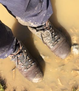
Because of the rain much of the 18 miles of actual footpath was soggy underfoot and a walking pole proved invaluable much of the time. In truth I wish I hadn’t ditched the gaiters from my pack in order to save a bit of weight!
Day 1 – Scalby to Dalby Forest
There’s a short farm path from the cliff top at Scalby to the busy main A165 road which has to be crossed to begin the first of the many tarmac stretches through Scalby to a grass track alongside a wide beck delightfully named North Back Drain. Most of the rest of day one was on tarmac, gravel or forest roads, but we had a welcome cuppa at the Everly Country House Cafe before plodding through Wrench Green and the long climb into Wykeham Forest. There were some fine views across Troutsdale as the route followed the contours into Dalby Forest and South Moor Farm and a warm welcome from the owners Chris and Bob. The b and b is pretty remote but offers an evening meal which was definitely the best dinner of the walk.
Day 2 – Dalby to Newton-upon-Rawcliffe
Despite forecasts of torrential rain, thunder and strong winds, the morning dawned fine and sunny for what turned out to be a day of two halves! Wide forest tracks took us remarkably quickly to the Hole of Horcum, a deep moorland
RAF Flyingdales radar scanner with Blakey Topping in the foreground.
valley off the main Whitby to Pickering road at Saltersgate. On the way we could see the radar of RAF Fylingdales, not as attractive as the old three white golf ball like radomes….and clearly defined was Blakey Topping, not to be confused with Blakey Ridge several miles away across the moors. Across the road we joined a great moorland track which took us all the way to the pretty village of Levisham passing Sievy Pond and Dundale Pond on the way.
As they say in the best horse racing circles, from Levisham the going became soft – very muddy indeed, as the route passed through Levisham Wood to cross the North Yorkshire Moors Railway at Farwath where the farmer reported the beck was five feet above its normal level at the overnight rains of the previous week. My walking companion had by now left me to the sound of the birds, and the hoot of the steam train as it made its way from Whitby to Pickering and I climbed Farwith hill to join a track which took me to the next excellent overnight at Swan Cottage b and b in Newton-on-Rawcliffe.
Day 3 – Newton-on-Rawcliffe to Hutton-le-Hole
A wonderful woodland walk down Newton Bank
The day began with an amazing walk through woodland down Newton Bank and across marshy ground and alongside another wood to the hamlet of Stape. With rain threatening, the pace quickened as the shelter of trees was clearly not far ahead. As it turned out it didn’t rain, but the paths to Cawthorne were excellent and I glimpsed a fox scurrying away at the sound of my squelching footsteps. Later the unmistakable call of hundreds of pheasants – probably rich picking for the fox family though actually reared to provide fun for the sporting hunter and game pie for many a diner.
Navigation was slightly tricky through Cropton village but only because of the illogical placing of the Tabular Hills signs. Generally the signage was good but more of this later. I resisted the temptation to stop for a pint in the village of Appleton-le-Moors and pressed on via field and farm tracks, and towards Hutton-le-hole was joined by a couple from Sheringham in Norfolk, who were tackling a shorter walk using a guidebook and were finding it difficult to keep on track.
Walking is thirsty work but with a pub next door to the b and b, all was well
Spotting my map, they assumed, perhaps wrongly, that I knew what I was doing and tagged along until we reached Hutton – a picture post-card tourist village if ever there was one. I stayed over at the Barn Tea Room where I was made very welcome. Conveniently the Barn is next door to the village inn. I ought to mention here that the Barn Tea Room breakfast got my vote as best of the walk, but it was a close run thing; all the Yorkshire breakfasts I enjoyed set me up for the day, making a packed lunch almost unnecessary.
Day 4 – Hutton-le-Hole to Helmsley
The longest day for two reasons. Firstly the day’s route was 13 miles, and secondly, wrong turns added at least a mile, maybe more to the distance and finally there was a lot of walking on hard surfaces, not good for tired toes.
Mistake one was within minutes of leaving Hutton. The map shows the footpath leaving the main road outside the village, but in reality it leaves from a side road, visible if you are paying attention, but I was bouncing along pleased to be starting another day’s walking, and missed it by half a mile. Back on track I crossed fields and moorland to the village of Gillamoor and a good distance on tarmac toward Caldron Mill where the next map reading error added another mile. Until now, where two paths or bridleways crossed, all the Tabular Hills waymarks pointed in the direction you needed to walk. Suddenly they were only on the gatepost with direction arrows saying bridleway or footpath. I assumed the wrong direction was the right one! Serves me right for relaxing. For the third time I was glad of my smart phone and the OS App which, signals permitting, allowed me to pinpoint exactly where I was. Even without a phone signal, the built in GPS provided me with a map reference – great to check you are where you think you are, or not!
Getting out of the valley from Hold Cauldron worked up a bit of a sweat before a walk, through damp woodland to Skiplam and the longest road walk yet to Nawton Tower and the long descent into Riccal Dale and incredibly steep walk out up Hasty Bank.
The steep path up Hasty Bank doesn’t look anything like as hard to climb as it really was
By now I was on the home straight so to speak: roads and tracks took me to the broad forest road through Ash Dale and into Helmsley, looking forward to, you guessed, a pint, and a curry.
Reflecting on the four days, the highlights were without doubt the stunning views, the wonderful woodland paths, and the solitude: en-route I met three cyclists, three walkers and a lady on a horse.
Transport: Parking is limited around the Scalby start of the walk but there are buses from both Whitby and Scarborough to Scalby: service X93 will drop you off at the Three Jolly Sailors, in Burniston, about a mile’s walk from the start. From Helmsley, the service 128 will take you back to Scarborough (an alternative return might be to get off this bus in Pickering and use the North Yorkshire Moors Railway to Whitby).
The Swan Cottage b and b offers a package where they will drop you off at the start of each section and pick you up at the end of the day.
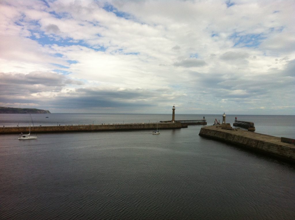
The Esk is the North Yorkshire river which flows into the sea at my home town of Whitby, that delightful – if perhaps at times overcrowded – holiday resort more famous these days for the goth festivals which take place there from time to time.
As a school boy I learnt that Whitby was the port from where Captain James Cook first sailed and then on locally built ships circumnavigated the globe discovering (for Europeans at any rate) Australia, New Zealand and the Hawaiian islands. It was also the centre of Britain’s whaling trade and at one time recorded as the sixth busiest port in the kingdom before the Victorian gentry turned it into a popular holiday town.
When I was younger the harbour was where I fished for tiddlers, locally called pennock, at Boots’ Corner and later, further inland, where I tried to catch brown trout, being unable to afford the much more expensive salmon fishing licence.
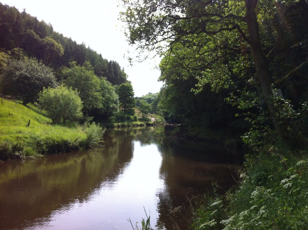
It was with some excitement then 50 years later I set out to walk to the source of the river high on the North Yorkshire moors and then follow it to the sea – passing through some of the most spectacular scenery the area has to offer.
The 37 mile route begins in the moorland village of Castleton and after a loop to visit the source of the river, The Esklets, returns to Castleton and follows the valley to the pretty villages of Danby, Lealholm, Glaisdale and Egton Bridge before skirting the North Yorkshire Moors Railway HQ in Grosmont and heading for Sleights, Ruswarp and then into Whitby. Full details of the route are on the North Yorkshire Moors National Park Website
With fellow walkers Jennifer, Michael and Daniel I booked into the Eskdale Hotel, in Castleton, for the night before the walk, a comfortable enough place though beware, they don’t serve meals on Sunday evenings. This lack meant we were lucky enough to eat instead at the Fox and Hounds Inn, at Ainthorpe.
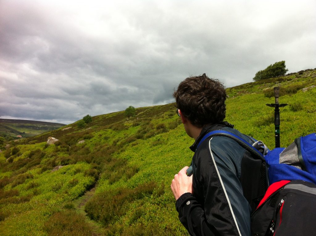
Dan looking back along Westerdale
Day 1, Castleton to Blakey Ridge, about 9 miles: We began with a road section to Dibble Bridge before joining the footpath along the side of Westerdale and more road near Little Hograh Moor. Here we met two guys from York who told us they walked on the Yorkshire Moors every week and warned us of the risk of encountering adders. Although the June weather was fair it was, in our view too cold for snakes but apparently not. It seems this intrepid pair had been sitting on a wall enjoying a hot drink from their flask, when an adder – presumably looking for inner warmth too – curled itself around a mug of coffee they’d set on the wall to cool.
Continuing to follow the moor edge the route dipped into a boggy valley where numerous springs and streams – the Esklets – come together to make the beginnings of the Esk itself. A stiffish climb took us onto High Blakey Moor to join the old Rosedale Railway (part of the Coast to Coast route) and a sprint for a pint and hot shower at the Lion Inn, on Blakey Ridge, at 1325 feet, the highest pub on the North York Moors.
A word of warning here: our rooms at the Lion Inn were excellent, but if you eat dinner in the restaurant, think carefully before having a starter – the portion sizes are humungous. In fact we all agreed the plates were so full of food it was off-putting (clearly a third world problem). When we mentioned this to the staff their reply was that they got a lot of similar complaints and that a huge amount of food was wasted as a result.
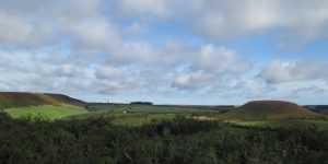
Stunning moorland views
Day 2, Blakey Ridge to Lealholm, about 13 miles: A short road section took us across Rosedale Head and into Danby Dale, where we followed the contours into Castleton arriving in time for tea and sandwiches back at the Eskdale Inn, which redeemed itself for failing to provide us with dinner on Sunday.
We followed the river (and the Esk Valley Railway) to Danby and after passing the North York Moors Visitor Centre climbed the steep hill up Oakley Side to Danby Beacon a moorland high point, once the site of an RAF radar station closed in 1954 and demolished three years later.
From here, it was as they say, all downhill into Lealholm and the truly fabulous, and friendly, Board Inn, where the welcome and the food was exceptional.
The river Esk
Day 3, Lealholm to Whitby, about 12 miles: Dan left the walk here having urgent business elsewhere, hopping on the train into Whitby while the three of us began what we all agreed was the toughest day of the walk – could it be that it was a hot day, or that we were tired? Following the railway again we were quickly passing the long, drawn out village of Glaisdale, pausing to photograph Beggar’s Bridge, built, it is said by Thomas Ferris in 1619. Ferris was poor but hoped to marry the daughter of a wealthy local squire. Planning to go and seek his fortune, on the night that he left, the river was swollen with rainfall preventing him making a last visit to his sweetheart. He eventually returned a rich man, married the squire’s daughter, and built Beggar’s Bridge so that no other lovers would be separated as they were.
As we next walked through Arnecliff Wood we attempted silence in the vain hope of spotting a deer or two but did marvel at the stone slabs (or trods) which formed the path from there, almost it seemed right through to Whitby, wondering at the effort needed to cut and lay them, and what these sandstone blocks would cost at the local garden centre!
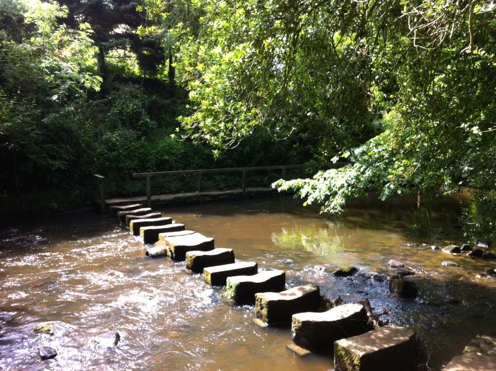
The stepping stones at Egton Bridge
After the toe-numbing descent on the road into Lealholm, the 1 in 3 hill known as the Delves into Egton Bridge seemed easy and top marks to the landlord of the Horseshoe Hotel which sits at the bottom of the bank in Egton Bridge. Even though he wasn’t actually open for business he kindly made us a welcome pot of tea. Refreshed, we crossed the river via the two sets of stepping stones and made our way along the Egton Estates toll road towards Grosmont and the path along Eskdaleside to Sleights.
Up until we reached Sleights station we were full of praise for the thorough way-marking on the trail. So good was it, that we rarely had to check our maps; not so in Sleights where the signposts seemed to stop and we were left wandering around new housing developments in Lowdale (definitely not there when I was a lad).
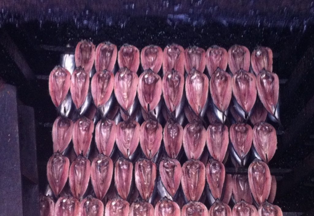
Fortune’s Kippers, not to be missed
Once we picked up the route again past the cricket club and up Echo Hill we started to see Whitby Abbey in the distance. By the time we reached the village of Ruswarp the Bridge Inn was too tempting to pass without topping up our fluid levels; yet the walk was almost done, just Ruswarp Fields to cross and the walk across town to our B and B, and the following day a trip to buy Fortune’s Kippers before catching the midday train back along the Esk Valley to our cars in Castleton.
I’m up for change; for years I worked in an industry where technology streamlined processes to the point where you can now do at home with a cheap pc and inexpensive software, what used to require hundreds of thousand pounds investment in kit and staff.
That said, I’m also nostalgic for some of the things technology has stolen from us as our world has embraced all things electronic.
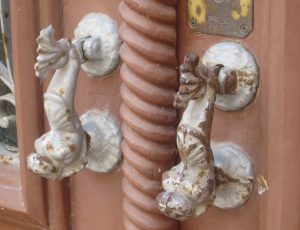
Take the door knocker. That was once new technology. Our ancestors were happy to announce their arrival at a friend’s home by simply shouting “Get the cauldron on, we’ve come for a cuppa”. Then as bits of sacking gave way to wooden doors it became necessary to bang on the door to announce your arrival and for poorer folk who couldn’t afford a staff (or stave) to beat out their arrival note, it meant sore knuckles for days afterwards.
These knockers double as the door knob
Time passed until an inventive village blacksmith with time on his hands (and perhaps sores caused when he visited Aunt Ethelred a few days earlier) came up with a door knocker. Probably a plain affair, cheaply made, because his clients probably couldn’t rub two groats together.
Benjamin Franklin was reputed to have said: “Without continual growth and progress, such words as improvement, achievement, and success have no meaning” and so it was that Mr Smith’s idea was embraced by others and soon the wealthy were adorning their front doors with elaborate knockers, often intended to outdo their neighbours with their flair and panache.
In Roman times apparently the use of a metal ring as a door knocker allowed the wealthy home owner to chain slaves to his front door so to welcome guests (I guess they had to be chained up or they might be stolen or indeed run away).
I suppose the advent of the door bell was inspired by the practice of ringing church bells to warn of the advance of marauders or maybe if your home was a castle, a knock on the door just wouldn’t cut it.
Mind, even door bells demonstrate the advance of technology. When I was a youngster our bell had to be wound up (you turned the bell-ringy bit) and the operation was simple, the outside button was connected to a rod which passed through the door when when pressed, turned on the clockwork mechanism.
I well remember my best mate’s gran, who was a bit better off than us, had a chime which consisted of two long tubes hanging in the hall beneath a box of electrical components. When the door button was pressed small hammers tapped on the tubes to create the sounds.
I’m red faced to admit, but in more recent years we had a wireless door bell! A
This has a range of 1000 feet and 52 chimes
battery powered button on the door activated the ringer unit which could be carried round the house – very useful if you were sorting out the attic.
All this new fangledness has one sad aspect though. I doubt if future generations of holidaymakers will bother to take pictures of the plastic, double glazed front doors of our homes, gasping as they press the shutter, just look at the knocker on that.
If you want to see more pictures of amazing door knockers try Google and click images.
The clocks have gone forward, and as if by magic, the weather is noticeably warmer on this, the third day of spring. In fact, in a few minutes I am off outside to start the task of getting the garden into shape for what I hope will be a long hot summer.
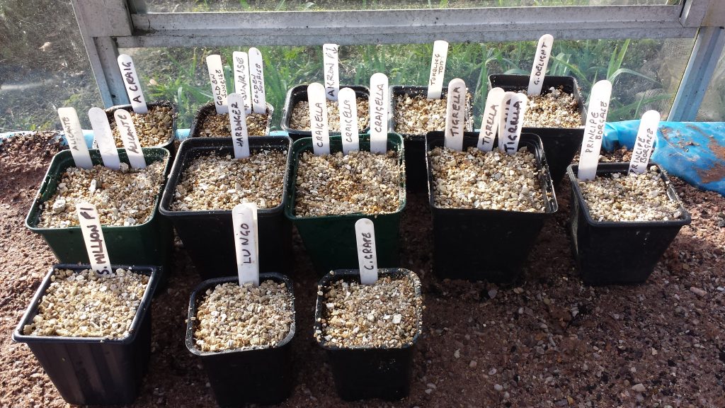
I say start, but in truth I actually began a couple of weeks ago when the traditional task of sowing the tomato seeds took place. I’m lucky enough to have two greenhouses at Peel Towers and in the smaller of the two I have an eight foot long heated propagating bench which I made out of scrap timber and a heating cable I bought some years ago in a garden centre clearance sale.
But although this is probably ten times bigger than the propagators most have at their disposal, as any gardener will tell you, no matter how big any thing is (be it propagator, greenhouse or vegetable plot) it is never big enough. In the case of my tomatoes, it is because I grow plants for family and friends and because I like to try different varieties.
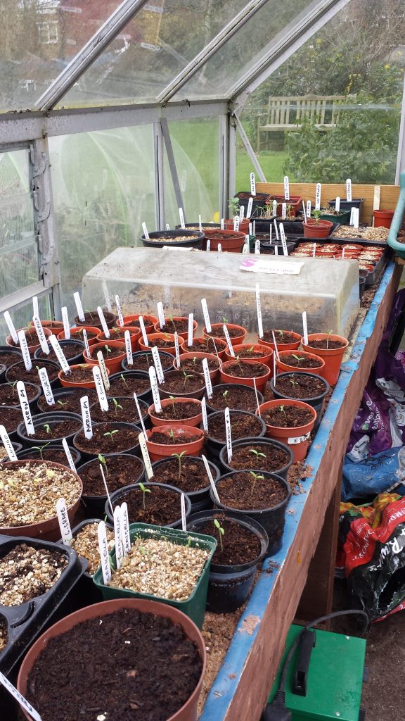
Within a week the seeds were up and needed transplanting into pots of their own so suddenly space was at a premium, especially as flower seeds and an indoor sowing of broad beans were all vying for attention.
Outside, the lawn has already had two cuts and that has brought its own problems: the moss I failed to deal with in the autumn has now spread and threatens at least 60% of the surface area and, no doubt, 60% of my time in the coming weeks.
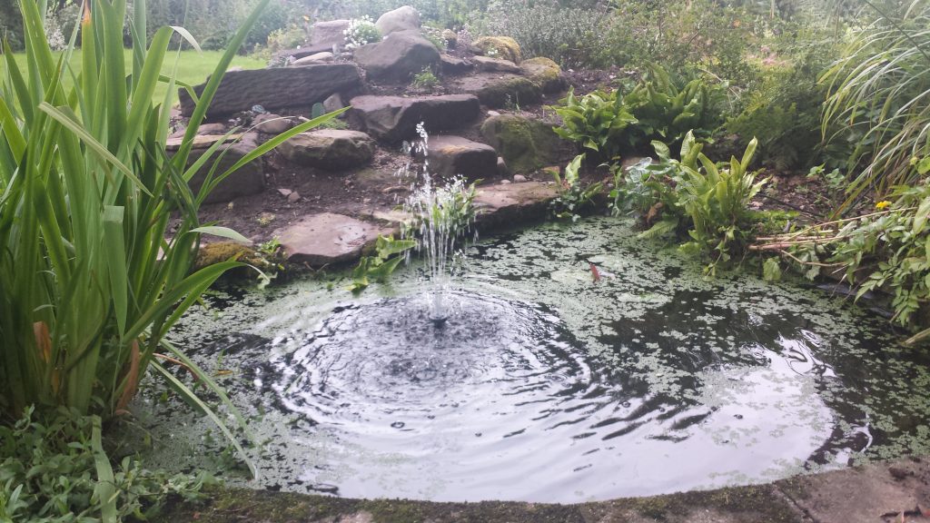
The garden pond is now being inspected daily in the hope that some frog spawn will appear. The whole issue of frogs in garden ponds has lead to much discussion. We’ve been here for five years now, and although I regularly see toads skulking on dark damp corners, I have yet to see a frog.
About 18 months ago I emptied the pool completely and cleaned out vast quantities of dodgy looking black sludge which must have taken years to accumulate. I also cut back overgrown aquatic plants and installed a fountain, not for its doubtful aesthetic qualities but because a) I like to hear water splashing when I sit in the garden on a summers day, and b) it keeps the water aerated and thus stops the water going green and cloudy. I was sure this would attract lots of wildlife but not so far, unless you count the granddaughter who took a brief (accidental) dip.
I mentioned to a neighbour that I was searching for some frog spawn to help nature on its way, and received a rather amused look. He argued that the frogs would find the water soon enough and I would be then overrun with the things, regretting it every time I cut the grass.
Personally I don’t mind doing frog patrol to chase the amphibians out of the way when I get the lawn mower out, so each day I check in the hope that even one solitary frog has decided they want to make my pond their home. They haven’t turned up yet, but I still hope.
The big job this year is to get the wide border back under control. I’ve battled with the couch grass and nettles ever since we arrived here – and lost. This time I think I will cover where I can with heavy plastic to smother the growth and then use ground cover and shrubs. Life is too short to spend hours each week weeding the same patch.
There are also the three raised vegetable beds to sort out (one is full of strawberries for grandson Samuel’s favourite jam, and they need renewing, and I need one of them ready because soon it will be Easter.
Don’t get me wrong, I don’t have any faith; you see my grandfather always planted his early potatoes on Good Friday. I suspect this was more to do with the fact that he had time off from work, than it was a horticultural necessity, but it’s a nice tradition and I’m going to stick to it.
As a journalist I was taught never to apologise for what you write – after all if you have to start with an apology, why would anyone want to read your words? However after putting fingers to keys to discuss the art of making Bolognese sauce I feel I ought to offer an extremely strong reason for wanting to discuss the less than delicate matter of clearing up after your dog.
My justification is the call by an MP for dog owners to abandon the plastic bag when clearing up after their pet and instead use “stick and flick”. Tory MP Conservative Anne Main was speaking during a debate about the number of plastic bags littering the countryside.
Before I go on, I should, as an aside, reveal that when I worked in broadcasting, one of the trickier jobs when producing a phone-in show, was to generate calls from listeners. Some days there would be a plethora of topics people wanted to chat about, but on quiet days, we could guarantee a jammed switch board if we introduced either religion or dog-dirt as the subject of the morning.
I can also confirm that one of the biggest bones of contention among boat owners on the UK waterways network, is the number of dog owners who think they don’t need to clear up when their animal fouls the towpath, ensuring that unsuspecting boaters step in the stuff when they moor their boats. I’ve even seen people mark the stuff with brightly coloured mini-flags to help other boaters avoid the the mess.
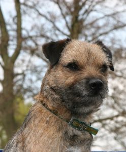
Benji, the current Peel beast
I’ve owned or shared ownership of a dog of one sort or another since I was eight or nine. Rikki was a fox terrier and, in theory, belonged to my elder sister but as he and I spent many, many hours walking the cliffs, beaches, ravines and countryside around my Yorkshire home town, he sort of adopted me, sleeping at the foot of my bed.
In those days you didn’t carry a pocket full of nappy bags to clear up after your pet but you were thoughtful of others and made sure that, if he was caught short in the street, he was positioned in the gutter; or if in the countryside, definitely not on the path or places where unsuspecting pedestrians, particularly children, might step in the mess. Nature took care of the rest.
I remember smiling when the poop-a-scoop was introduced (apparently invented by a Californian man in the early 70s) and considered it something to be used by city living poodle owners.
Over time of course the dog mess situation has worsened. There are around eight-and-a-half million dogs in the UK and the amount of their daily deposits doesn’t bear thinking about – except they are one of the leading sources of E. coli (fecal coliforms) bacterial pollution, Toxocara canis and Neospora caninumhelminth parasite pollution. (Wikipaedia)
And while an individual animal’s deposit may not measurably affect the environment, the cumulative effect of thousands of dogs in an urban area can create serious problems due to contamination of soil and water supplies.
Despite all of this, I share the politicians obvious frustration when walking in the countryside, to see plastic bags full of dog dirt hanging on the hedges, left there by thoughtless owners, presumably because the local authority didn’t provide a suitably marked bin. Again some quick searching on the web led to the discovery that these bags can take between 10 and 500 years to decompose – which sounds to me to be far more polluting than allowing nature to dispose of the poo.
This is why I’m delighted to learn from the honourable member for St Albans, that the Forestry Commission is now urging dog owners to use the “stick and flick” method of disposal. That is, you find a stick and flick the mess into the undergrowth where it won’t be trodden on by exploring youngsters but will decay naturally.
I should stress that this policy applies only to what the Commission calls “wider forest areas.” Around main visitor centre areas, owners are still being asked to use a bag and the bins provided near by, lest instead of having to take care not to tread in the stuff, we have to constantly duck and dive to avoid flying canine ordure.


 I mentioned to a neighbour that I was searching for some frog spawn to help nature on its way, and received a rather amused look. He argued that the frogs would find the water soon enough and I would be then overrun with the things, regretting it every time I cut the grass.